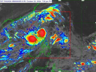
MANILA, Philippines — The southwest monsoon remains the predominant weather system on Wednesday, August 7, but state weather bureau PAGASA spotted a tropical depression that has formed outside the Philippine area of responsibility.
The cyclone, located 2,005 kilometers east northeast of extreme northern Luzon as of 3 a.m., has no direct effect yet on weather conditions. The tropical depression, that is yet to adopt an international name, was almost stationary, the bureau said in its 4 a.m. advisory,
It is the seasonal monsoon, locally known as “habagat,” that is still triggering rains in some parts of the country, particularly central and southern Luzon and Visayas.
The bureau is also monitoring a low-pressure area recorded 575 km northeast of Itbayat, Batanes.
Forecast
Zambales, Bataan, Occidental Mindoro and Palawan are likely experience cloudy skies with scattered rains and thunderstorms due to habagat, PAGASA said.
Habagat is also causing partly cloudy to cloudy skies with isolated rainshowers or thunderstorms over Metro Manila, Visayas, CALABARZON, Bicol Region and the rest of MIMAROPA.
The rest of the country, meanwhile, will have partly cloudy to cloudy skies with isolated rainshowers or thunderstorms due to localized thunderstorms. These conditions may cause flash floods or landslides during severe thunderstorms, PAGASA warned.
Winds. Winds will be light to moderate, coming from the southwest to west over Northern Luzon and from the south to southwest over the rest of the country. Coastal waters will be slight to moderate, with wave heights ranging from 0.6 to 2.1 meters.


Be the first to comment