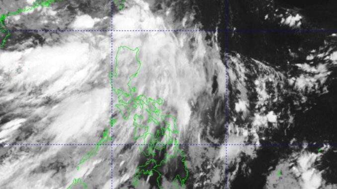
MANILA, Philippines — Tropical depression “Igme” left the Philippine Area of Responsibility (PAR), according to the state weather bureau, the Philippine Atmospheric, Geophysical and Astronomical Services Administration (Pagasa).
According to the weather bureau’s Saturday morning bulletin as of 5 a.m., Igme was moving northwestward at 40 kilometers per hour (kph), with maximum sustained winds of 55 kph near the center and gusts of up to 70 kph.
The eye of “Igme” was 520 km north-northeast of Itbayaf, Batanes, which is well outside the PAR, Pagasa added.
However, the southwest monsoon enhanced by the storm will continue to bring rains over parts of Northern Luzon, particularly Ilocos Region, Abra, Benguet, Batanes, Babuyan Islands, the extreme eastern portion of Isabela, Nueva Vizcaya, and Zambales on Saturday.
A gale warning is also issued over the western seaboard of Ilocos Region.
“Sea travel is risky for small seacraft, including all types of motorbancas,” Pagasa warned.
Batanes and Babuyan Islands are forecast by the weather bureau to have monsoon rains, while Ilocos Region, Zambales and Bataan will have occasional rains.
Metro Manila, the rest of Luzon, Western Visayas, Northern Samar, Eastern Samar, and other parts of Samar are expected to have cloudy skies with scattered rains and thunderstorms because of the monsoon.
The rest of the Visayas will have partly cloudy to cloudy skies with isolated rain showers and thunderstorms because of the monsoon, while Mindanao will also have the same conditions as the Visayas, but only due to localized thunderstorms.
As for Igme, it will remain a tropical depression on Saturday, while a passing frontal system over the East China Sea will weaken the tropical depression into a low pressure area on Sunday, the weather bureau said.


Be the first to comment