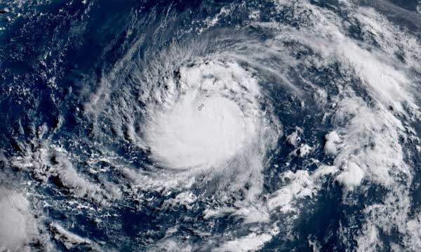
Tropical Storm “Julian” (international name: Krathon) has slightly strengthened while moving over the Philippine Sea, the state weather bureau said.
PAGASA in a 5 p.m. weather bulletin said that “Julian” was spotted 380 kilometers east of Aparri, Cagayan.
Moving west-northwest at 15 kilometers per hour, Julian was carrying peak winds of 75 kph and gusts of up to 90 kph, PAGASA said.
Tropical Cyclone Wind Signal (TCWS) No. 1 has been raised in the following areas: Batanes; Cagayan; including Babuyan Islands; Isabela; Apayao; Kalinga; the eastern portions of Mountain Province (Natonin, Paracelis) and Ifugao (Aguinaldo, Alfonso Lista); Ilocos Norte; Abra; and the northern portion of Aurora (Dilasag, Casiguran).
Earlier, PAGASA said “Julian” has intensified into a tropical storm from a tropical depression.
The tropical storm’s center was last estimated 465 kilometers east of Aparri in Cagayan. It is slowly moving south-southeastward.
PAGASA said Julian has maximum sustained winds of 65 kilometers per hour (kph) near the center and gustiness of up to 80 kph.
The tropical storm is forecast to move west-southwestward or westward today, then generally northwestward tomorrow through Monday toward the Batanes-Babuyan Islands area, before accelerating north-northeastward over the waters east of Taiwan from October 1 onward.
Julian will continue to intensify throughout the forecast period and is expected to reach the typhoon category on Monday.
“There is an increasing likelihood of rapid intensification, and the possibility of reaching super typhoon category is not ruled out. This tropical cyclone will be closest to Batanes and/or Babuyan Islands at or near peak intensity,” PAGASA reported. Ratziel San Juan


Be the first to comment