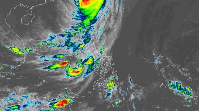
MANILA, Philippines — State weather bureau PAGASA has further downgraded the Batanes to Wind Signal No. 2 at most, as Typhoon Leon (international name: Kong-Rey) made landfall in Southeastern Taiwan on Thursday, October 31.
As of 4 p.m., PAGASA located Leon’s eye approximately 320 kilometers north northwest of Itbayat, Batanes, which is also within the vicinity of Chiayi County, Taiwan.
Typhoon Leon is currently moving northwestward at 25 km per hour (kph), carrying peak winds of 155 kph near the center and gusts of up to 255 kph.
PAGASA also reported strong to typhoon-force winds expanding outwards to a maximum of 590 km from Leon’s eye.
Wind signals
PAGASA placed the following areas under tropical cyclone wind signals:
Signal No. 2, gale-force winds (62 kph to 88 kph)
- northern portion of Batanes (Itbayat)
Signal No. 1, strong winds (39 kph to 61 kph)
- rest of Batanes
- Babuyan Islands
- northern portion of mainland Cagayan (Santa Praxedes, Sanchez-Mira, Claveria, Pamplona, Abulug, Ballesteros, Aparri, Camalaniugan, Buguey, Gonzaga, Santa Teresita, Santa Ana)
- northern portion of Ilocos Norte (Bangui, Burgos, Dumalneg, Adams, Pagudpud)
Storm surge. While lower wind signals have been raised, the state weather bureau warns coastal communities of moderate risk of life-threatening storm surges that can reach as high as 2.0 to 3.0 meters above normal tide levels in Batanes.
Forecast track
PAGASA
Crossing Taiwan, Leon is projected to turn northeastward over the Taiwan Strait until it reaches the East China Sea, further losing strength due to land interaction.
PAGASA anticipates Leon to exit the Philippine area of responsibility (PAR) by 2 p.m. on Friday, November 1, as it moves up to 750 kilometers north of Itbayat, Batanes.


Be the first to comment