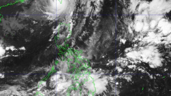
MANILA, Philippines — Typhoon “Julian” continues to weaken on Thursday as it is forecast to reenter the Philippine Area of Responsibility (PAR) within the day, the state-run weather agency said.
In fact, the typhoon is no longer a threat to the country as it would further weaken into a severe tropical storm, weather specialist Benison Estareja of the Philippine Atmospheric Geophysical and Astronomical Services Administration (Pagasa) said.
But Signal No. 1 remains up over Batanes in extreme Northern Luzon, he said.
Pagasa said the trough of the typhoon has been affecting Ilocos Region, Cordillera Administrative Region, the rest of Cagayan Valley and Central Luzon where scattered rain showers and thunderstorms would prevail.
Meanwhile, the easterlies – winds coming from the east that pass through the Pacific Ocean and carry warm and humid weather- are also bringing overcast skies over Davao Region, SOCCSKSARGEN (South Cotabato, Cotabato, Sultan Kudarat, Sarangani and General Santos) and Caraga.
The state weather bureau said Metro Manila and the rest of the country would likely experience partly cloudy to cloudy skies with isolated downpours or thunderstorms due to the localized thunderstorms in 24 hours.


Be the first to comment