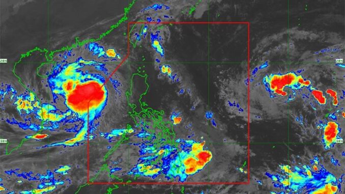
MANILA, Philippines — Severe Tropical Storm Kristine has left the Philippine area of responsibility, but another tropical cyclone is set to enter PAR over the weekend, according to the Philippine Atmospheric, Geophysical and Astronomical Services Administration (PAGASA).
Kristine left PAR at around 2 p.m. yesterday after battering Luzon over the past days, but it could make a U-turn toward the Philippine landmass tomorrow or Monday.
Despite Kristine’s exit, tropical cyclone wind signal No. 1 was still raised over Ilocos Norte, Ilocos Sur, La Union, Pangasinan, Apayao, Kalinga, Abra, Mountain Province, Ifugao, Benguet, Cagayan including Babuyan Islands, Isabela, Quirino, Nueva Vizcaya, Nueva Ecija, Tarlac, Zambales, Bataan, Pampanga, Bulacan, Metro Manila, the northern portion of Rizal and northern portion of Cavite.
Kristine was last monitored 410 kilometers west of Sinait, Ilocos Sur at 4 p.m., carrying maximum sustained winds of 95 km per hour near the center and gustiness of up to 115 kph.
It is expected to gradually intensify over the West Philippine Sea and could still be upgraded into a typhoon category.
PAGASA said Kristine will continue to move westward over the West Philippine Sea today and may loop counterclockwise while moving eastward toward PAR.
However, state meteorologists said this is still dependent on the behavior of another tropical cyclone that will enter PAR.
Another cyclone is set to enter PAR in Kristine’s wake as tropical storm Kong-rey, which will be named Leon once it enters PAR, was monitored 2,410 km east of Southeastern Luzon.
It was carrying maximum sustained winds of 65 kph and gustiness of up to 80 kph.


Be the first to comment