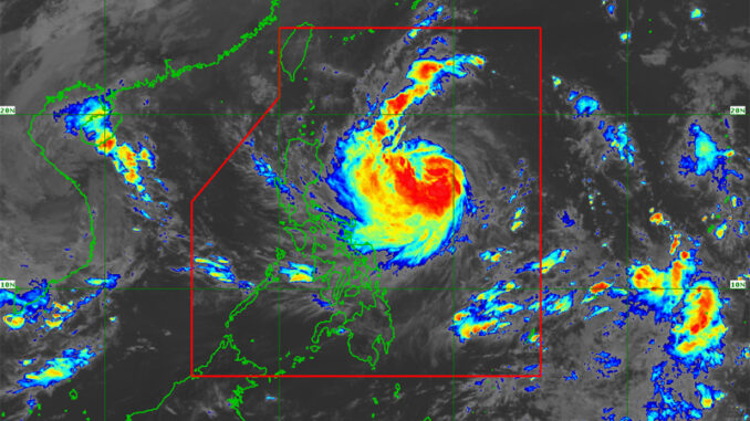
Tropical Storm “Leon” (international name: Kong-Rey) intensified into a severe tropical storm and may reach typhoon category within 24 hours, the state weather bureau said on Monday.
In an 11 am advisory issued by PAGASA, Tropical Cyclone Wind Signal (TCWS) No. 1 is still hoisted over the eastern portion of mainland Cagayan (Santa Ana, Lal-Lo, Gattaran, Baggao, Santa Teresita, Gonzaga, Peñablanca), the eastern portion of Isabela (Maconacon, Divilacan, Ilagan City, San Pablo, Cabagan, Tumauini, Palanan, San Mariano, Dinapigue), and the northeastern portion of Catanduanes (Pandan, Bagamanoc, Panganiban, Viga).
During its period of closest approach to Batanes, PAGASA says there is an increasing chance that the severe tropical storm will reach super typhoon category after rapidly intensifying over the Philippine sea.
The weather disturbance is moving westward at 20 kilometers per hour with maximum sustained winds of 95 kilometers per hour near the center and gusts of up to 115 kilometers per hour.
Its center was last estimated at 780 km east of Echague, Isabela.
Severe tropical storm “Leon” is forecast to move west northwestward today through Tuesday morning, then turn northwestward until it makes landfall along the eastern coast of Taiwan on Thursday evening or Friday early morning.
According to PAGASA, “Leon” is expected to turn to the northeast towards the East China Sea and exit the Philippine Area of Responsibility on Friday morning or afternoon after crossing the landmass of Taiwan.
“There is an increasing possibility of further westward shift in the track forecast of “Leon” but within the limits of the forecast confidence cone. As such, a landfall or close approach scenario on Batanes is not ruled out,” it warned.


Be the first to comment