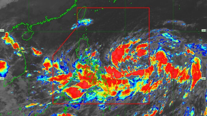
A low pressure area (LPA) monitored in the east of Southeastern Luzon developed into a tropical depression locally named as ‘Kristine’ with tropical cyclone wind signal no. 1 raised over Luzon, Catanduanes, Visayas, the northeastern portion of Northern Samar, and the northeastern portion of Eastern Samar.
As of 5:00 AM on Monday, state weather bureau PAGASA has monitored the tropical depression moving west southwestward at 30 kilometers per hour with maximum sustained winds of 55 km/h near the center and gustiness of up to 70 km/h. The eye of the storm was estimated at 1050 kms east of Southeastern Luzon.
‘Kristine’ is forecast to move generally westward until Tuesday morning before turning north northeastward for the rest of the forecast period. On the forecast track, a landfall and passage over Northern Luzon is expected on Friday afternoon.
PAGASA said ‘Kristine’ will intensify into a tropical storm in the next 12 hours and is likely to reach severe tropical storm category by tomorrow afternoon or evening and typhoon category by Thursday (24 October) afternoon or evening, prior to landfall over the northeastern portion of Cagayan.
“Further intensification is likely, given the favorable environmental conditions – high SST and low wind shear – for development over the area,” PAGASA said.


Be the first to comment