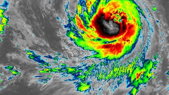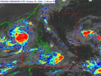
MANILA, Philippines — Severe Tropical Storm Leon (international name: Kong-Rey) has slightly intensified while moving over the Philippine Sea and may reach typhoon strength within the next 12 hours.
As of 4 a.m., October 29, PAGASA said that Leon was spotted 645 kilometers east of Tuguegarao City, Cagayan.
Carrying peak winds of 110 kilometers per hour and gusts up to 135 kph, Leon is moving west northwestward at 10 kph.
Wind signals
PAGASA hoisted Signal No. 1 for several areas across Luzon and Visayas, which are as follows:
Luzon
- Batanes
- Cagayan including Babuyan Islands
- Isabela
- Quirino
- Nueva Vizcaya
- Apayao
- Kalinga
- Abra
- Mountain Province
- Ifugao
- Benguet
- Ilocos Norte
- Ilocos Sur
- La Union
- Aurora
- northern portion of Quezon including Polillo Islands (General Nakar, Infanta, Real), Camarines Norte
- eastern portion of Camarines Sur (Tinambac, Siruma, Goa, Lagonoy, San Jose, Garchitorena, Caramoan, Presentacion, Tigaon, Calabanga, Saglay)
- Catanduanes
- eastern portion of Albay (Rapu-Rapu, Bacacay, City of Tabaco, Tiwi, Malilipot, Malinao, Santo Domingo, Manito)
- northeastern portion of Sorsogon (Prieto Diaz, City of Sorsogon, Gubat)
Visayas
- eastern portion of Northern Samar (San Roque, Pambujan, Catubig, Laoang, Palapag, Gamay, Lapinig, Mapanas, Mondragon)
- northern portion of Eastern Samar (Jipapad, Arteche, Oras, San Policarpo)
Strong winds ranging from 39 to 61 kph may be expected in at least 36 hours or intermittent rains may be expected within 36 hours.
Heavy rains, severe winds
The storm’s outer rainbands may impact Extreme Northern Luzon, depending on its path.
Leon is expected to enhance the southwesterly windflow that was previously triggered by Tropical Storm Trami (formerly Kristine), which could bring rainfall to Visayas, Mindanao and the western portion of Southern Luzon.
PAGASA warned that Leon may lead to the hoisting of Wind Signal Nos. 3 or 4 in Extreme Northern Luzon, with the possibility of Signal No. 5 as well.
Gusty winds are expected in the following areas in the coming days:
- Tuesday, October 29: Bataan, Metro Manila, CALABARZON, MIMAROPA, Bicol Region, Visayas, Dinagat Islands, Surigao del Norte and Camiguin.
- Wednesday, October 30: Bataan, Metro Manila, CALABARZON, MIMAROPA, Bicol Region, most of Visayas and Dinagat Islands.
- Thursday, October 31: Aurora, Quezon, MIMAROPA, Bicol Region and Dinagat Islands.
Sea conditions
PAGASA said that sea conditions over the next 24 hours make travel dangerous in the following areas:
- Up to 8 meters: Northeastern Cagayan seaboard
- Up to 7 meters: Batanes and other Cagayan seaboards
- Up to 6 meters: Isabela seaboards
- Up to 4.5 meters: Ilocos Norte, Aurora, Camarines Norte, northern and eastern Polillo Islands, Camarines Sur, Catanduanes and northern Quezon
- Up to 3 meters: Remaining Quezon, Ilocos Sur, eastern Albay, Sorsogon, northern and eastern Northern Samar and eastern Eastern Samar
- Up to 2.5 meters: La Union, Pangasinan, Dinagat Islands, Surigao del Norte, Surigao del Sur and Davao Oriental.
- Up to 2 meters: Remaining Luzon and Visayas seaboards, northern Mindanao
Track, intensity outlook
The state weather bureau said that Leon will move generally west northwestward on Tuesday, transitioning to a northwestward trajectory on Wednesday.
The storm is likely to make landfall on Taiwan’s eastern coast on Thursday afternoon or evening.
After crossing Taiwan, Leon will head north toward the East China Sea and exit the Philippine area of responsibility by Thursday evening or early Friday morning.
While the storm’s track may shift slightly west, it could still approach Batanes.
Leon is expected to intensify quickly and may become a typhoon within the next 12 hours. There is also a chance it could reach super typhoon status as it gets closer to Batanes.


Be the first to comment