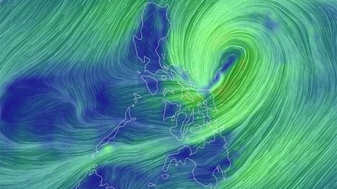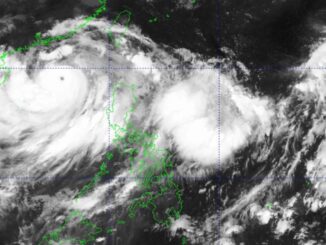
MANILA, Philippines — Signal No. 2 was hoisted in Catanduanes as Tropical Storm Kristine (international name: Trami) maintained its strength while hovering over the Philippine Sea east of Bicol Region.
As of 10 a.m. Tuesday, October 22, PAGASA reported that Kristine is currently 335 kilometers east of Virac, Catanduanes.
It has maximum sustained winds of 65 kilometers per hour near the center and gustiness of 80 kilometers per hour.
PAGASA hoisted the following Tropical Cyclone Wind Signals:
Signal No. 2
Signal No. 1
Luzon
- Ilocos Norte
- Ilocos Sur
- La Union
- Pangasinan
- Apayao
- Kalinga
- Abra
- Mountain Province
- Ifugao
- Benguet
- Cagayan including Babuyan Islands
- Isabela
- Quirino
- Nueva Vizcaya
- Aurora
- Nueva Ecija
- Tarlac
- Zambales
- Bataan
- Pampanga
- Bulacan
- Metro Manila
- Cavite
- Laguna
- Batangas
- Rizal
- Quezon including Pollilo Islands
- Masbate including Ticao Island, Burias Island
- Marinduque
- Romblon
- Camarines Norte
- Camarines Sur
- Albay
- Sorsogon
Visayas
- Eastern Samar
- Northern Samar
- Samar
- Leyte
- Biliran
- Southern Leyte
Mindanao
- Dinagat Islands
- Surigao del Norte including Siargao – Bucas Grande Group
PAGASA said that Kristine will move northwestward until it makes landfall over Isabela or northern Aurora by Wednesday, October 23.
“Kristine is forecast to gradually intensify into a severe tropical storm before making landfall. Slight weakening will occur while crossing Northern Luzon. Over the West Philippine Sea, Kristine may reach typhoon category before exiting the Philippine Area of Responsibility region on Friday (25 October),” PAGASA said said.
The state weather bureau has also issued a gale warning over the eastern seaboard of Luzon, the southern seaboard of Southern Luzon, and the eastern seaboard of Visayas.


Be the first to comment