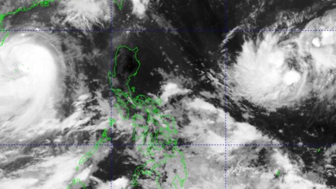
MANILA, Philippines — The trough of Severe Tropical Storm “Kristine” will continue to affect the western section of Southern Luzon even after it has left the country, the Philippine Atmospheric Geophysical Astronomical Services Administration (Pagasa) said on Saturday.
In its bulletin early Saturday morning, Pagasa said that Kristine was 630 kilometers west of Bacnotan, La Union with maximum sustained winds of 95 kilometers (km) per hour near the center, moving westward at 20 kph.
Another storm outside the Philippine Area of Responsibility (PAR), Kong-Rey, is 1,825 km east of Central Luzon, with maximum sustained winds of 65 kph near the center and moving northwestward at 35 kph.
Occidental Mindoro and Palawan, in particular, will have cloudy skies with scattered rains and thunderstorms because of the trough of Kristine, while the whole of the Visayas, Zamboanga Peninsula, Northern Mindanao, and Caraga will experience the same because of a southwesterly windflow.
Metro Manila and the rest of the country will have partly cloudy to cloudy skies with isolated rain showers or localized thunderstorms.
Kristine exited the PAR on Friday and was headed to the West Philippine Sea but not before its strong winds and heavy rains affected more than two million people, left close to 50 people dead and about P80 million in crop damage
Should Kong-Rey enter, it is expected to be named Leon.


Be the first to comment