


MANILA, Philippines — Typhoon ‘Julian’ (international name: Krathon) is back inside the Philippine area of responsibility (PAR) on Thursday after it left Batanes in a state of calamity.
Julian already exited PAR on Tuesday but state weather bureau PAGASA forecasted that it may re-enter. Tropical Cyclone Wind Signal No. 1 remains hoisted over Itbayat, Batanes.
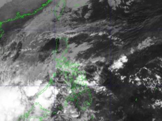
“At 8:00 AM today (October 3), the center of the eye of Typhoon #JulianPH re-entered the Philippine Area of Responsibility,” PAGASA said in a Facebook post.
In PAGASA’s morning weather bulletin, Julian is not expected to directly impact the country except for Batanes and the Babuyan Islands, where cloudy skies with scattered rains.
Julian has maximum sustained winds of 120 kilometers per hour (kph) near the center and gustiness of 165 kph. It was last reported 245 kilometers northwest of Itbayat, Batanes.
Impact and warnings
PAGASA warned Batanes and the Babuyan Islands of “possible flash floods or landslides due to moderate to at times heavy rains.”
Batanes is still under a state of calamity, as pronounced by Batanes Governor Marilou Cayco.
Julian is forecast to make landfall over Southern Taiwan this afternoon.
Meanwhile, the Ilocos Region, Cordillera Administrative Region, the rest of Cagayan Valley, and Central Luzon can expect cloudy skies and scattered rains due to Julian’s trough.
In the southern regions of the country, Davao Region, SOCCSKSARGEN and Caraga are also affected by rain and thunderstorms due to the easterlies, or winds coming from the east.
Metro Manila and the rest of the country could expect fair weather with chances of isolated rain and thunderstorms.


Be the first to comment