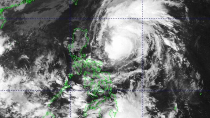
MANILA, Philippines — Severe Tropical Storm “Marce” has intensified into a typhoon and may make landfall over Babuyan Islands or mainland Cagayan on Thursday or Friday, the state-run weather agency said on Tuesday.
In its 11 a.m. bulletin, the Philippine Atmospheric Geophysical and Astronomical Services Administration (Pagasa) said the typhoon was moving west-northwestward at 30 kilometers per hour (kph) while packing maximum sustained winds of 120kph near the center and gustiness of up to 150kph.
Its center of the eye was last spotted some 590 kilometers east of Baler, Aurora, the weather agency said.
Under Signal No. 1 are Batanes, Cagayan including Babuyan Islands, Isabela, Ilocos Norte, Apayao, Abra, Kalinga, Mountain Province, Ifugao, the northern portion of Nueva Vizcaya (Diadi, Bagabag, Ambaguio, Villaverde, Bayombong, Solano, Quezon and Kasibu), the northern portion of Quirino (Diffun, Saguday, Cabarroguis, Aglipay and Maddela) and the northern portion of Aurora (Dilasag, Casiguran and Dinalungan) in Luzon.
Due to uncertainty in the strength of the high pressure area north of Marce, Pagasa administrator Nathaniel Servando said its forecast track may still change and bring the landfall point to mainland Cagayan-Isabela area.
“Marce is expected to continue intensifying and may reach its peak intensity prior to possible landfall over Babuyan Islands or Cagayan,” the Pagasa chief said.
The typhoon may exit the Philippine Area of Responsibility either Friday evening or early Saturday morning, the state weather bureau said.


Be the first to comment