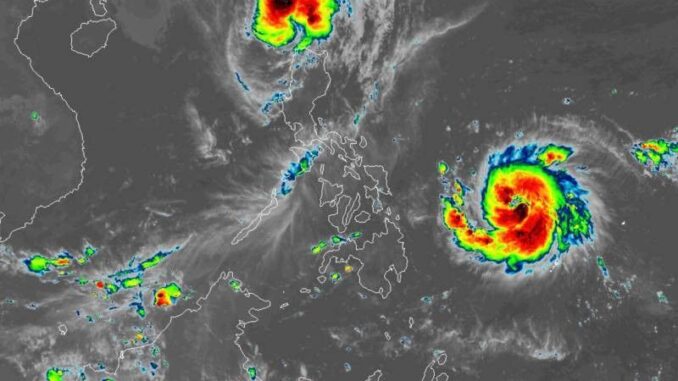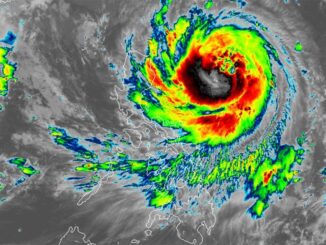
MANILA, Philippines — PAGASA said Severe Tropical Storm Pepito (Man-Yi) has intensified significantly and is approaching typhoon strength, while Typhoon Ofel (Usagi) has begun to weaken as it moves over Luzon Strait early Friday, November 15.
As of 4 a.m., Pepito was spotted 795 kilometers east of Guiuan, Eastern Samar, with peak winds reaching 110 kilometers per hour and gusts up to 135 kph. It is moving westward at a speed of 25 kph, with a central pressure of 980 hPa.
Ofel’s center was located 100 kilometers northwest of Calayan, Cagayan, with maximum sustained winds of 120 kilometers per hour (kph) near the center and gusts reaching 150 kph. Moving north-northwestward at 20 kph, Ofel has a central pressure of 975 hPa.
Wind signals
The following areas are under Signal No. 1 due to Severe Tropical Storm Pepito:
Luzon
- Catanduanes
- eastern portion of Camarines Norte (Vinzons, Talisay, Daet, Mercedes, Basud), the eastern portion of Camarines Sur (Caramoan, Garchitorena, Presentacion, San Jose, Lagonoy, Tinambac, Goa, Siruma, Tigaon, Sagñay, Calabanga, Naga City, Magarao, Bombon, Pili, Ocampo, Iriga City, Buhi)
- eastern portion of Albay (Rapu-Rapu, City of Tabaco, Malilipot, Santo Domingo, Bacacay, Legazpi City, Malinao, Manito, Tiwi)
- eastern and southern portions of Sorsogon (Juban, City of Sorsogon, Barcelona, Bulusan, Magallanes, Gubat, Santa Magdalena, Casiguran, Bulan, Irosin, Matnog, Prieto Diaz, Castilla)
Visayas
- Northern Samar
- northern portion of Eastern Samar (San Policarpo, Arteche, Jipapad, Maslog, Oras, Dolores, Can-Avid)
- northeastern portion of Samar (Matuguinao, San Jose de Buan)
PAGASA hoisted tropical cyclone wind signals over the following areas in Luzon due to Typhoon Ofel:
Signal No. 3
- western portion of Babuyan Islands (Calayan, Is., Dalupiri Is., Fuga Is.)
- northwesternmost portion of mainland Cagayan (Claveria, Santa Praxedes)
- northernmost portion of Ilocos Norte (Pagudpud)
Signal No. 2
- rest of Babuyan Island
- northwestern portion of mainland Cagayan (Sanchez-Mira, Pamplona, Abulug, Ballesteros)
- northern portion of Apayao (Calanasan, Luna, Santa Marcela)
- northern portion of Ilocos Norte (Piddig, Bacarra, Adams, Dumalneg, Vintar, Bangui, Burgos, Pasuquin, Carasi)
Signal No. 1
- Batanes
- rest of Cagayan, the northern portion of Isabela (Quezon, Cabagan, Santa Maria, San Pablo, Maconacon, Santo Tomas, Delfin Albano, Tumauini)
- rest of Apayao, Kalinga
- northern and central portions of Abra (Manabo, Pidigan, Tayum, Langiden, Boliney, Sallapadan, Bucloc, La Paz, Peñarrubia, Dolores, Bangued, Bucay, Daguioman, Lacub, Tineg, Lagayan, Licuan-Baay, Malibcong, San Juan, Lagangilang, Danglas)
- rest of Ilocos Norte
- northern portion of Ilocos Sur (Sinait, Cabugao, San Juan, San Ildefonso, Magsingal, Santo Domingo, Bantay, San Vicente)
Heavy rains, severe winds
Severe Tropical Storm Pepito is not yet affecting any land areas directly, though Typhoon Ofel is expected to bring moderate to heavy rainfall over Cagayan, Batanes and Ilocos Norte.
The state weather bureau warned of moderate to significant wind impacts in areas under Signal No. 3, while minor to moderate impacts are likely in Signal No. 2 zones, and minimal impacts are possible in Signal No. 1 areas.
Storm surge, sea conditions
The coastal areas of Camarines Sur, Catanduanes, Albay, Sorsogon, Northern Samar, Eastern Samar and Samar face a moderate to high risk of life-threatening storm surges, with possible water levels rising 2 to 3 meters above normal tides over the next 48 hours.
A gale warning is also in effect over the northern and eastern seaboards of Northern Luzon due to Typhoon Ofel, while no similar warning has been issued for Pepito.
Track, intensity outlook
PAGASA said Pepito is expected to continue on a westward path, with a potential shift to west-northwest as it moves over the Philippine Sea.
It may make landfall along the eastern coast of Central or Southern Luzon by the weekend, with a projected exit from the Philippine area of responsibility (PAR) by Monday evening, November 18.
Typhoon Ofel is forecast to move further north-northwestward, likely leaving the northwestern boundary of PAR by Friday afternoon.
However, it may re-enter PAR over the weekend, moving northeastward toward southern Taiwan, where it is projected to remain for the rest of the forecast period.


Be the first to comment