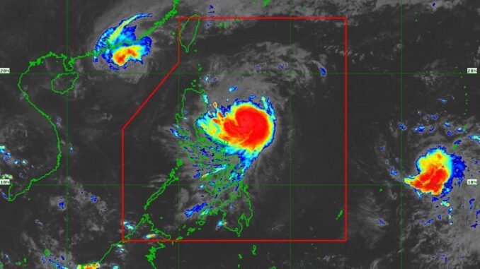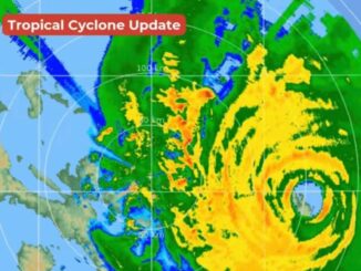
MANILA, Philippines — The state weather bureau has placed several areas under Tropical Cyclone Wind Signal No. 2 as Typhoon “Ofel” (International name: Usagi) makes its way to Northern Luzon.
Ofel is set to make landfall along the coasts of Cagayan or Isabela by Thursday, November 14. This will be the third cyclone to hit Luzon this week, following Marce and Nika..
PAGASA has raised the following wind signal warnings:
- Tropical Cyclone Wind Signal No. 2:
- Luzon: Cagayan including the Babuyan Islands, the northern and eastern portions of Isabela (Maconacon, Divilacan, Palanan, San Pablo, Cabagan, Santa Maria, Santo Tomas, Tumauini, Ilagan City) and the eastern portion of Apayao (Flora, Luna, Santa Marcela, Pudtol)
- Tropical Cyclone Wind Signal No. 1:
- Luzon: Batanes, the rest of Isabela, Quirino, the northern portion of Nueva Vizcaya (Kasibu, Ambaguio, Solano, Bayombong, Quezon, Bagabag, Diadi, Villaverde), Apayao, Kalinga, Abra, Mountain Province, Ifugao, Ilocos Norte and the northern portion of Aurora (Dilasag, Casiguran, Dinalungan, Dipaculao)
After its landfall in Cagayan, Ofel is set to emerge over the Luzon strait, making another landfall over the Babuyan Islands.
In a separate advisory, PAGASA said that Cagayan and Isabela can expect heavy to intense rains due to Ofel.
Meanwhile, Ilocos Norte, Apayao, Abra, Kalinga, Mountain Province, Ifugao, Quirino, Nueva Vizcaya, Aurora and Catanduanes can expect moderate to heavy rains.
PAGASA also said that there may be a storm surge from 1 to 3 meters in the next 48 hours in the following areas: Batanes, Ilocos Norte, Ilocos Sur, Cagayan including Babuyan Islands, Isabela and northern Aurora.
Cagayan can also expect very rough or high seas in the following areas:
- The eastern seaboard of mainland Cagayan; the seaboard of Babuyan Islands: Up to 10 meters
- The seaboards of Isabela; the remaining seaboard of mainland Cagayan: Up to 8 meters
- The seaboard of northern Aurora: Up to 5 meters
“Sea travel is risky for all types or tonnage of vessels. All mariners must remain in port or, if underway, seek shelter or safe harbor as soon as possible until winds and waves subside,” PAGASA said.
Meanwhile, PAGASA is also monitoring Tropical Storm Man-Yi, which will be named Pepito once it enters the Philippine area of responsibility.


Be the first to comment