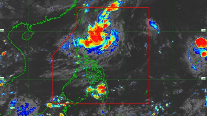
Tropical Depression “Julian” as of Friday afternoon, maintained its strength over the Philippine Sea east of Batanes, according to the state weather bureau PAGASA.
The center of “Julian” was estimated to be 445 kilometers east-southeast of Itbayat, Batanes, or 425 kilometers east of Basco, Batanes. It was moving southwestward at 20 kilometers per hour (kph) with maximum sustained winds of 55 kph near the center and gustiness of up to 70 kph.
Julian is forecast to follow a looping path over the waters east of Batanes and Cagayan in the next five days.
The tropical depression will intensify continuously throughout the forecast period and could reach the tropical storm category by Friday night or Saturday morning. It might develop into a typhoon on Sunday.
PAGASA said the tropical depression might come closer to extreme Northern Luzon: “Rapid intensification is increasingly likely.”
Initially, the tropical cyclone will head south-southwestward or southwestward until early Sunday while decelerating. It will then move slowly northwestward or north-northwestward beginning mid-Sunday and finally turn northward or north-northeastward on October 1 onward.


Be the first to comment