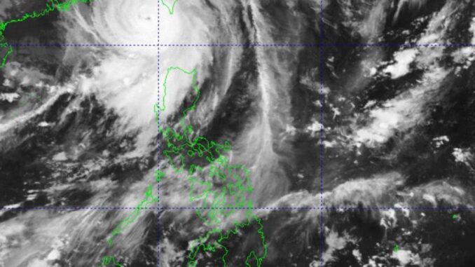
MANILA, Philippines — Super Typhoon “Julian” weakened into a typhoon as it was expected to re-enter the Philippine Area of Responsibility (PAR) either Wednesday night or early Thursday morning, the state-run weather agency said.
Moving north-westward slowly, Julian was estimated over 280 kilometers (kms) west-northwest of Itbayat, Batanes while packing maximum sustained winds of 165 kilometers per hour (kph) near the center and gustiness of up to 205kph.
In its 5 a.m. bulletin, the Philippine Atmospheric Geophysical and Astronomical Services Administration (Pagasa) said Signal No. 1 was still raised over Batanes, Babuyan Islands, the northern and western portions of Ilocos Norte (Pasuquin, Sarrat, Paoay, Bangui, Vintar, Burgos, Pagudpud, Bacarra, Currimao, Adams, Pinili, San Nicolas, Dumalneg, Laoag City, Badoc and City of Batac), and the northwestern portion of mainland Cagayan (Santa Praxedes, Sanchez-Mira and Claveria).
Weather specialist Grace Castaneda said Pagasa noticed a significant change in the track forecast of the typhoon.
She said the typhoon was still forecast to turn northeastward towards the southwestern coast of Taiwan, where it was expected to make landfall Wednesday night or early Thursday morning.
“After landfall, Julian may move erratically over the landmass and coastal waters of Taiwan before emerging over the Taiwan Strait on Friday evening or early Saturday morning,” the Pagasa forecaster said.
At present, there is no dominant weather system influencing the general motion of Julian, the latest bulletin said.
As such, considerable shifts in the track forecast of succeeding bulletins are not ruled out, she stressed.
Likely to re-enter PAR either Wednesday night or early Thursday morning, Julian, however, will eventually exit the country either Friday or Saturday morning, the state weather bureau said.
Meanwhile, the easterlies — wind coming from the east that pass through the Pacific Ocean and carry humid and warm weather – are affecting Davao Region, SOCCSKSARGEN (South Cotabato, Cotabato, Sultan Kudarat, Sarangani and General Santos) and BARMM (Bangsamoro Autonomous Region in Muslim Mindanao where overcast skies would be likely.
Metro Manila and the rest of the country will be experiencing isolated rain showers or thunderstorms due to the localized thunderstorms, Pagasa said.


Be the first to comment