


October 28, 2024 | 12:41pm
MANILA, Philippines — Tropical cyclone “Leon” (international name: Kong-rey) grew into a severe tropical storm as it rolled across the Philippine Sea on Monday, October 28. It is also forecast to become a typhoon within 24 hours.
State weather bureau PAGASA said Leon would likely strengthen and reach super typhoon status once it passes close to Batanes, where a landfall or close approach scenario is not ruled out, according to its 11 a.m. advisory.
As of 10 a.m., Leon was located 735 kilometers east of Casiguran, Aurora, and 780 kilometers east of Echague, Isabela, packing maximum sustained winds of 95 kilometers per hour and gustiness of up to 115 km per hour.
The storm has slightly accelerated, moving westward at 20 km per hour.
The state weather bureau has raised Signal No. 1 for several areas in Luzon but also warned that it could hoist Signal Nos. 3 or 4 during Leon’s passage, especially for extreme northern Luzon.
Signal No. 1 raised in areas in Luzon
PAGASA has issued Signal No. 1 for more areas in Luzon, warning of strong winds (with speeds ranging from 39 to 61 kph) within the next 36 hours. The affected areas are the following:
- Batanes
- Cagayan, including Babuyan Islands
- Isabela
- Ilocos Norte
- Abra
- Apayao
- Kalinga
- The eastern portion of Mountain Province (Natonin, Paracelis)
- The eastern portion of Ifugao (Aguinaldo, Alfonso Lista)
- The eastern portion of Quirino (Maddela)
- The northern portion of Aurora (Dilasag, Casiguran, Dinalungan)
- The northern portion of Catanduanes (Pandan, Bagamanoc, Panganiban, Viga, Gigmoto)
Residents in these areas should brace for potential flooding and rain-induced landslides due to strong winds.
Winds
Wind flow coming toward Leon has prompted PAGASA to warn that gusty winds are expected for the rest of the day in Batangas, most of MIMAROPA, most of the Bicol Region, Visayas, most of Northern Mindanao, and most of the Caraga Region.
Tomorrow, gusty winds are expected in Aurora, Metro Manila, CALABARZON, MIMAROPA, Bicol Region, Visayas, Dinagat Islands, Surigao del Norte, and Camiguin, while on Wednesday, these conditions will extend to Aurora, Metro Manila, CALABARZON, MIMAROPA, Bicol Region, Western Visayas, Negros Occidental, and Northern Samar.
Sea conditions. A gale warning has also been issued for the northern and eastern seaboards of Northern Luzon, with seas expected to be very rough, up to 5.5 meters. Mariners are advised to remain in port or seek shelter until conditions improve.
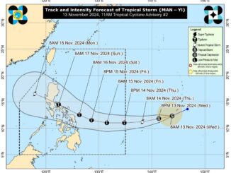
Forecast track
PAGASA said the forecast track for Severe Tropical Storm Leon (Kong-rey) indicates it will move west-northwestward today through tomorrow morning, October 29, before turning northwestward.
The storm is expected to make landfall along the eastern coast of Taiwan on Thursday evening, October 31, or early Friday morning, November 1.
After crossing Taiwan, Leon will turn northeast toward the East China Sea and exit the Philippine Area of Responsibility by Friday morning or afternoon.
The state weather bureau said there is an increasing possibility of a further westward shift in Leon’s track within the forecast confidence cone. As a result, a landfall or close approach scenario on Batanes is not ruled out.
Throughout its passage over the Philippine Sea, Leon is expected to rapidly intensify and may reach typhoon category within 24 hours. There is an “increasing chance” that Leon could reach super typhoon status during its period of closest approach to Batanes, PAGASA said.

Be the first to comment