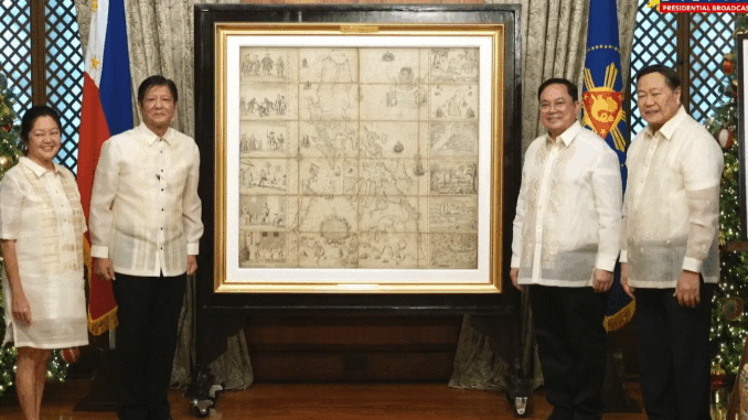
President Ferdinand Marcos Jr. on Friday received the original Murillo Velarde 1734 map, which has been vital in the country’s territorial assertions, during a turnover ceremony in Malacañang.
Dubbed as the “Mother of all Philippine Maps,” the Carta Hydro-graphica y Choro-graphica de las Yslas Filipinas was produced by Spanish Jesuit Friar Pedro Murillo Velarde with the help of two Filipinos, Francisco Suarez who drew the map and Nicolas dela Cruz Bagay who engraved it.
“The map encapsulates not just the geographical contours of our archipelago, but also the vibrant interplay of cultures, of peoples, and traditions that define our nation. The map features details that go far beyond rivers and coastlines,” said Marcos.
“It is as if Murillo Velarde, Sanchez, and Bagay sought to tell the world that ‘Yes, this is a collection of islands, but more than that this is a nation – a nation that is in the making’.”
The map returned to the Philippine shores after Mel Velarde purchased it during an auction at Sotheby in London in 2014.
It is also considered the first scientific map of the Philippine archipelago.
Two years later, the centuries-old map became an important evidence to assert the Philippines’ territorial claims in the West Philippine Sea wherein the Permanent Court of Arbitration at The Hague upheld Manila’s sovereignty in the disputed waters.
“What began as a map of the Philippines in the Spanish era became a formidable piece of evidence in our assertion of our rightful entitlements in the complex legal arena of the 21st century,” said Marcos.
“The Murillo Velarde map is an important gift from our past that defines the country’s territory and it is now our duty to carry its legacy forward to future generations.” —LDF, GMA Integrated News


Be the first to comment