


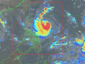
MANILA, Philippines — The low pressure area (LPA) off Davao City has a chance to develop into a tropical depression in the coming days, the Philippine Atmospheric Geophysical and Astronomical Services Administration (Pagasa) said on Tuesday.
Weather specialist Rhea Torres said that the LPA was estimated at 310 kilometers east-northeast of Davao City.
It is affecting Eastern Visayas, Caraga and Davao Region where overcast skies with scattered rain showers and thunderstorms would be likely, the Pagasa forecaster said.
“We are closely monitoring this LPA which may intensify into a tropical depression in the coming days,” Torres said.
“But this weather disturbance (LPA) is expected to bring rains until over the weekend in many areas in the country,” she added.
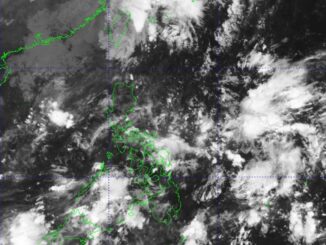
Meanwhile, the southwest monsoon locally known as “habagat” is particularly affecting Palawan where cloudy skies with scattered downpours and thunderstorms would prevail.
The same weather systems would be bringing isolated down showers or thunderstorms over Metro Manila, Zamboanga Peninsula, BARMM (Bangsamoro Autonomous Region in Muslim Mindanao), SOCCSKSARGEN (South Cotabato, Cotabato, Sultan Kudarat, Sarangani and General Santos), Cavite, Batangas, Bataan and Occidental Mindoro, the state-run weather agency said.
The localized thunderstorms are also bringing similar weather conditions over the rest of the country, Pagasa’s 5 a.m. bulletin said.

Be the first to comment